Canoeing the Lamprey
by Persis Ensor and Dick Lord
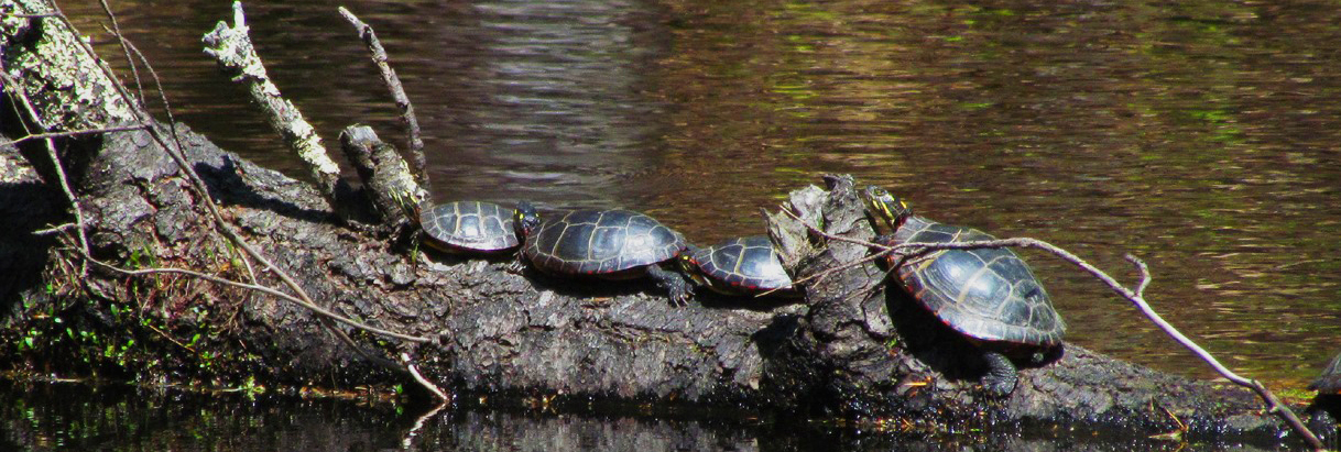
Many people enjoy canoeing the Lamprey River every year. About 36 miles of the river, from lower Deerfield to Newmarket, are canoeable in the springtime. The river winds through forests, pastures, houses, and town centers. There is abundant wildlife along the river, where you might see mergansers, herons, beavers, muskrats, migrating osprey, salmon, trout, salamanders, kingfishers, turtles, and many other fish and animals. There are wonderful patches of wildflowers throughout the canoeing season.
The use of the river by all citizens is a privilege. At some put-in sites, there is off-road parking. Some towns have strict regulations, so please check with each town before leaving your vehicle. Be thoughtful of landowners along the river and ask permission before making a rest stop that is obviously near a house. Be considerate of others by carrying out all garbage and clearing objects out of the river if possible. Remember, whatever we put into a river upstream has an effect on the river downstream.
Rapids Classification:
Class I: Very easy. Moving water with small waves, few obstructions.
Class II: Easy. Easy rapids with waves up to 3 feet, wide clear channels. Some maneuvering required.
Class III: Intermediate. Rapids with high, irregular waves often capable of swamping an open canoe.
Class IV: Difficult. Long, difficult rapids with constricted passes. Generally not possible for open canoes.
Class V: Very difficult.
Class VI: Extraordinarily difficult.
Safety Tips
- Make sure each person is a competent swimmer.
- Make sure everyone wears a life jacket.
- Do not overload the canoe.
- Be aware of weather conditions.
- Watch for quickly rising waters during spring melts.
- Alert someone of your plans.
- Travel with others.
- Sit low in the boat to avoid capsizing, and do not stand up in a canoe.
- Attach ropes to each end of the boat to assist in recovering the boat if it capsizes.
Canoeing Conditions along the Lamprey
Deerfield to Raymond (9 miles)
This stretch of the Lamprey River is navigable only during high water (late March to early May). The land along the banks is both forested and settled. Put in 2 miles south of Deerfield Center at the junction of Routes 43 and 107. You will find a narrow trout stream with Class I and II rapids and quickwater. There are many beaver dams on this part of the river.
One and a half miles into the run, before the first bridge, are two ledges. The first can be taken on the left in very high water, the second must be ported around. Following the first bridge is 2.5 miles of quickwater and a few Class I rapids, ending with a 100-yard rapid run before Route 101.
The next 1.5 miles are flat and wide, followed by one mile of Class I rapids to Langsford Road bridge. A Class II-III ledge is just below the bridge. The final 2.25 miles to Raymond are flat and wide. Take out at the side road bridge east of town since there is a gorge in the next mile.
Raymond to West Epping (4.5 miles)
From Raymond to the Routes 102/107 bridge is mostly flatwater or quickwater. There is a gorge within sight from the bridge. It is difficult to portage around the gorge. The run from the Routes 102/107 bridge to West Epping is 3.5 miles of flatwater, quickwater, and Class I rapids. This stretch is forested, with cottages dotting the shore. You may put in either at the bridge, when water is up over the 50 yards of Class II rapids, or directly into Dead Pond. The pond is a nice one-mile stretch past some cottages. After this, the river narrows, drops over some easy rapids, passes a small bridge and the Route 101 bridge, then continues 2+ miles to a dam below the next bridge.
West Epping to Wadleigh Falls (12 miles)
The first 3.5 mile run begins in a short pool. At the next bridge, Class II ledges continue for .5 mile. There are a few rock dams past the ledges that finally end at the Route 125 bridge in Epping.
The river winds through 3 miles of forested land to the Route 87 bridge. After the bridge, there is a beautiful 5 mile stretch through pastures and woods that brings you to the mouth of the North River. Another 1.25 miles and you reach the portage at Wadleigh Falls.
Wadleigh Falls to Newmarket (10.5 miles)
Many say the first 4 miles are excellent canoeing. This run is possible into early May, with two places (just below Lee Hook Road, and one mile further downstream) needing high water to run well. Past a brief rapid, just below Wadleigh Falls, there are 4 miles of river passing through shorelines of hemlocks and hardwoods. Below the bridge at Lee Hook Road, there are 200 yards of Class II rapids. The rapids end at a broken dam cutting diagonally across the river. The dam can easily be run by following the current instead of the shoreline.
The next five miles of this run pass a trailer park and end with a short rapid on either side of an island. From the island, it is 2.25 miles to the Wiswall Road bridge and the Wiswall Falls dam. For summer canoeing, you can put in at the dam and canoe upstream for the 2.25 miles to the island. Below the dam, there is a 200-yard Class II rapid that can be carried on the left in low water.
Packers Falls is .75 miles further. Take out at least 20 yards above the bridge and scout Packers Falls before attempting the run. Packers Falls is one of the most challenging rapids in the area. In the spring, it is a Class III run, and is often run well into the summer as a Class II drop. It is easy to portage around this drop.
There are two short Class II rapids just below Packers Falls, and finally a 2.5 mile run to the Newmarket dam. The river divides 3/4 miles from the last rapids and bears right. The Piscassic River enters from the right another 1/2 mile down. Take out in Newmarket on the left just above the dam. For summer canoeing, put in below the dam by Highland House.

