INTRODUCTION TO THE LAMPREY RIVER
How did the river get its name? No one knows for sure. The Native Americans called it the Pascassick, a name that is now confined to its small tributary in Newmarket, and is generally written Piscassic. In 1639, according to some records found in Exeter, the main river was called the Lamprill and Lamprel River. On a map drawn in 1680, a replica of which hangs in Lee's Mast Way School Library, it is labeled Lamper River. The lamprey eel, a fish that lives in the river in the early part of its life, swims out to sea, and then returns to spawn, might have been the source of the river's name.
The Lamprey River runs 47 miles from Betty's Meadows near Saddleback Mountain in Northwood Meadows State Park to Great Bay. Tributaries and lakes along the way contribute to its flow. The river's watershed is 212 square miles and includes the communities of Barrington, Brentwood, Candia, Deerfield, Durham, Epping, Exeter, Fremont, Lee, Newfields, Newmarket, Northwood, Nottingham, and Raymond.
The river drops more than 600 feet in elevation on its way to the Great Bay Estuary and has many waterfalls that lend themselves to the development of waterpower for manufacturing. Its many dams speak to its mill heritage. Raymond, Epping, Lee, Durham, and Newmarket were all sites of major water-powered industries such as grist, cider, cloth, paper, and lumber mills.
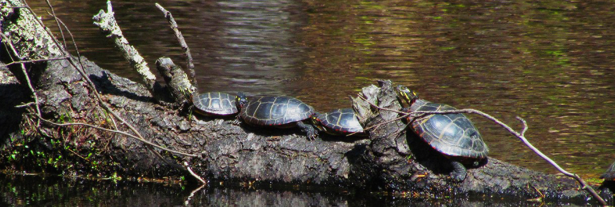
Along the river’s course, undisturbed areas provide habitat for a variety of wildlife. A canoeist on the river might be surprised by the slap of a beaver tail or the swish of an otter as it slides into the river. Other mammals found along the river include fishers, weasels, porcupines, deer, moose, and even an occasional black bear. The 150 or more bird species that have been sighted along the river mean that one can see and hear a variety of songbirds, ducks, and an occasional great blue heron. The shores are critical resting and feeding stations for many birds as they migrate north or south. The river’s wetlands, forests, fields, and banks provide life’s necessities to the state's six turtle species, including the endangered Blanding’s turtle.
The Lamprey's waters support trout, largemouth bass, pike, and white and yellow perch. These and other species attract fishermen from April through September. As Judith Spang mentions in her article, The Lamprey River Watershed Guide, the Lamprey is “a truly exceptional river… It contains every type of stream and river fish you could expect to find in New England."
The presence of freshwater mussels indicates a healthy river environment with swimmable, fishable waters. Six out of the nine river mussels found in New Hampshire have historically been found in the Lamprey. Although the number of common mussels remains high, the river has been losing its rarer mussels in recent years, probably due to the effects of heavy floods. These mussels have been scoured by sand and pebbles in the fast-moving water, or buried by sediment that settles as the flow slows when the flood water recedes.
Canoeists and kayakers look forward to spring "ice-out" every year when the river’s height and flow increase, providing a challenge to the most experienced paddlers. Spring through fall, however, there are many quiet, calm sections where one can easily paddle along. Parks and conservation areas in many of the communities along the river provide opportunities to enjoy a quiet walk or picnic. Although there are few public beaches, swimmers find their way into the cool waters on hot summer days.
The value of the Lamprey was first formally recognized in 1990 when the New Hampshire Legislature added the section that flows through Lee and Durham to the NH Rivers Management and Protection Program. The Lamprey River Advisory Committee, with representatives from Lee and Durham, was formed at that time. In 2011, the rest of the river and five of its tributaries were added to the program. Each of the fourteen towns in the watershed area is now also represented on the committee. The members work in collaboration with citizens, town leaders, and other groups to increase oversight and protection for the river. The committee has two main responsibilities:
- Create a river management plan.
- Review and submit comments on projects proposed along the rivers.
In addition to state protection, a 23 mile segment that begins in West Epping and ends at the McCallen Dam in Newmarket is afforded federal protection and funding under the National Park Service’s Wild and Scenic Rivers Program.
Still, the Lamprey is vulnerable, particularly to the pressures of a growing population and an increasingly developed landscape. The more people move into the area, and the more developed the land becomes, the more the river is subject to all sorts of pollution. Point-source pollution, which comes from easily identified sources such as discharge pipes from homes or factories, does occasionally occur on the river. The wastewater treatment plants in Epping and Newmarket are the only two regulated discharge points. Both release treated wastewater directly into the Lamprey. Non-point source pollution is far more worrisome for the Lamprey. It comes in the form of loose soil and sand from construction sites, chemical leaks from dumps and pavement, nutrients from failed septic systems, lawn run-off, agricultural fields, and streets, and salt from roads and parking lots. All of these pollutants are carried by water and they go where water goes: to streams, the river, and Great Bay.
The Lamprey is typical of many rivers in New England, with a strong historical connection to people who depended upon rivers for their livelihoods. Beginning 12,000 years ago, shortly after the last glacier that covered this area melted, people have utilized the river's resources and they continue to do so today. Although few people rely on the river for their livelihoods today, the river continues to be an asset to the people who live along it. Through study of this river, it is hoped that young people will come to understand the value of rivers to them culturally and personally, and do their utmost to preserve rivers for themselves and future generations.

